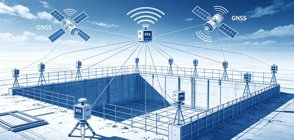
Real-Time Kinematic (RTK) GNSS technology is applied to foundation pit deformation monitoring to capture real-time displacement changes.
- A base station is installed on a stable reference point around the pit. It continuously receives satellite signals and calculates differential correction data.
- Multiple rover receivers are fixed on key monitoring points of the foundation pit retaining structure. They also track GNSS satellites.
- The base station transmits correction data to rovers via wireless communication.
- Rovers combine satellite observations and correction data to compute high-precision 3D coordinates in real time.
- By comparing continuous coordinate data, the system calculates horizontal and vertical displacement, tilt and settlement of the pit, so as to judge deformation status and warn of risks.