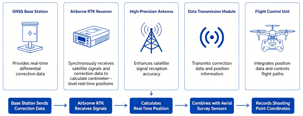
The UAV RTK differential positioning system mainly consists of an online NRTK service, an airborne RTK receiver, a high-precision antenna, a data transmission module and a flight control unit. The base station provides real-time differential correction data. The airborne RTK module synchronously receives satellite signals and correction data to calculate centimeter-level real-time positions. Combined with aerial survey sensors, it accurately records the geographic coordinates of each shooting point, effectively eliminating position drift and improving the overall accuracy of 3D modeling, terrain mapping and aerial measurement results.