Centimeter-Level Accuracy
Upgrading from “meter-level” to “centimeter-level” enables entirely new industries.
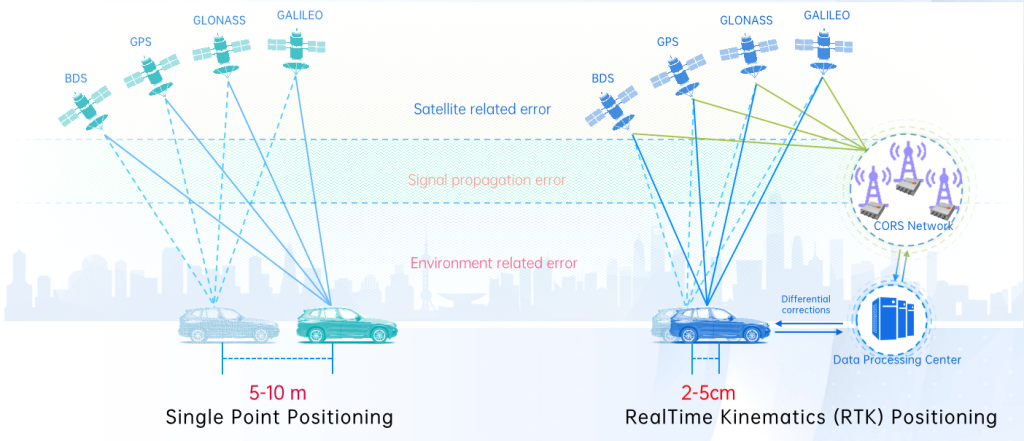
RTK (Real-Time Kinematic) is a high-precision satellite positioning technology that improves standard GNSS accuracy from meter-level to centimeter-level.
Standard GNSS positioning (like your phone’s GPS) typically has an accuracy of 5–10 meters, limited by errors such as satellite clock drift, atmospheric signal delays, and environmental interference. RTK eliminates most of these errors using a correction system:
- A network of fixed base stations (CORS network) continuously receives signals from GNSS satellites (GPS, BDS, GLONASS, Galileo).
- These stations calculate real-time correction data for the positioning errors.
- The corrections are sent to your mobile receiver (e.g., a surveying device or autonomous vehicle), which combines them with its own satellite measurements.
- The result is positioning accuracy down to 2–5 centimeters, in real time.
This leap in precision unlocks applications like autonomous driving, precision agriculture, surveying, drone mapping, and industrial automation.